Systems
The Floodplain We Sold Twice
Insurance and zoning can put the same dangerous land on the market again and again
We sold the view. Then we sold the risk. The river kept both copies.
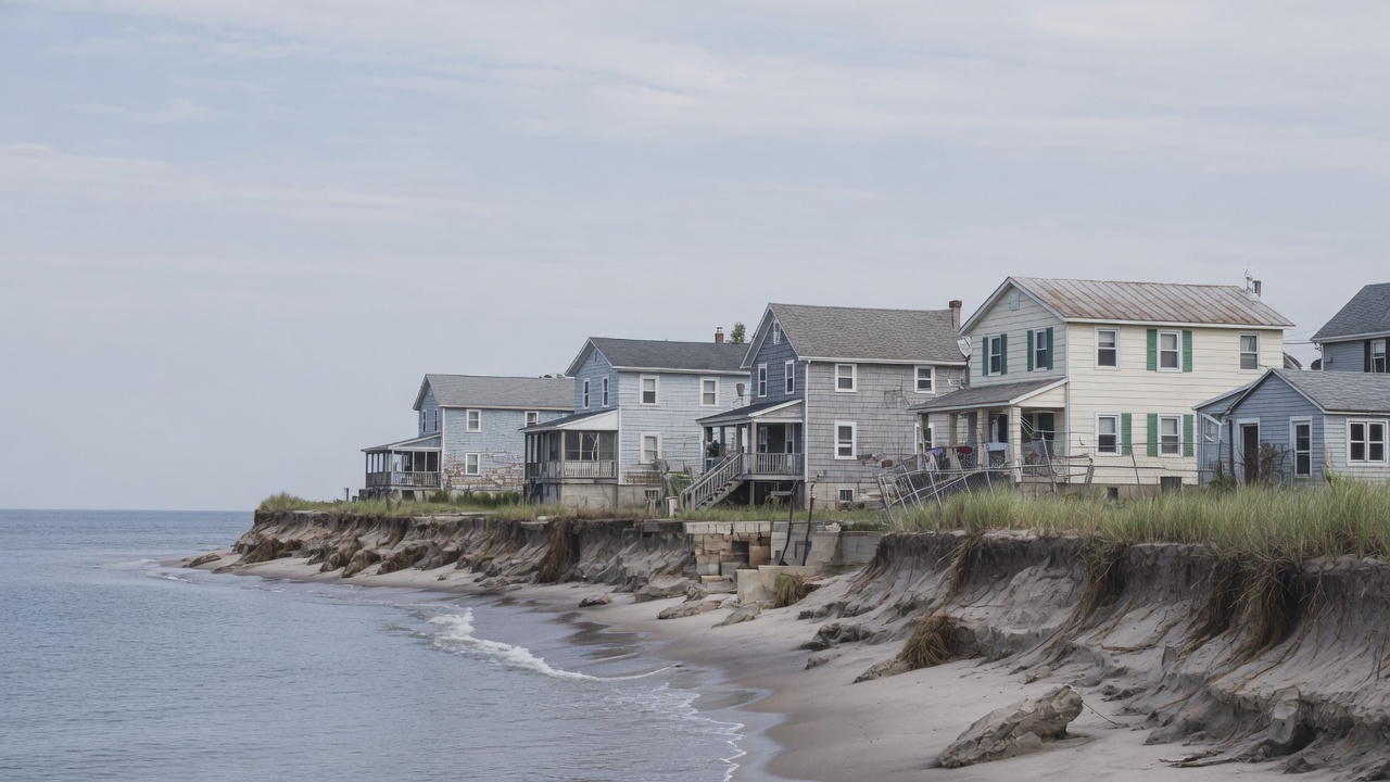
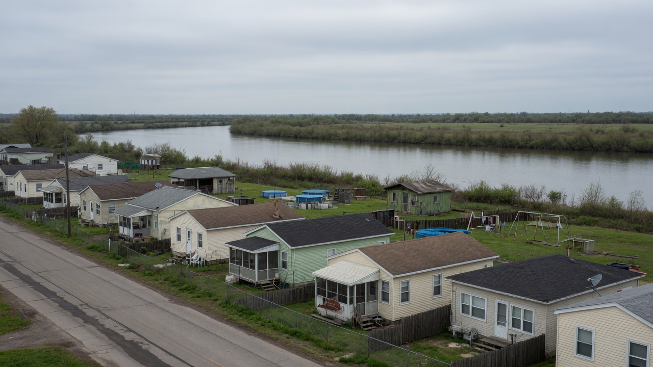
A floodplain is a river’s extra room. Build in it and you have bought a location that the water also claims. That would be a private tragedy if the bill stayed private. It often does not. Maps, levees, cheap insurance, and the expectation of federal or national aid can turn a dangerous parcel into a normal mortgage. The house looks like a household decision. The system that made the mortgage rational is public.
This is established as an incentive structure. It is not a claim that every flooded family gamed a system. Most inherited a map, a lender, a town that needed tax base, and a river that had been described, on paper, as a zoning category.
Two sales
The first sale is the lot: proximity, a school, a river path, a porch from which the water looks like scenery. Rivers have always attracted settlement. The soil is good. The transport was, for a long time, the water itself. Gilbert White, in the 1945 dissertation that still sits under American flood policy, wrote that floods are “acts of God” but flood losses are “largely acts of man.” He was not denying hydrology. He was naming the second act: occupancy.
The second sale is the risk, sliced into premiums, disaster declarations, and the quiet assumption that a house which has been wet will be made dry enough to occupy again. When the water comes, we call it a natural disaster. Follow the connection and some of it is a market that was not allowed to say no, or that said no only after the carpet had been replaced twice.
The National Flood Insurance Program was created in 1968, after private flood insurance had largely withdrawn from the product. The bargain was public. The federal government would offer coverage that the private market would not, on condition that participating communities adopted minimum floodplain-management rules and that maps—Flood Insurance Rate Maps—would say where the high-risk zone was. Lenders regulated by the federal government would, in that zone, require the insurance. Outside it, the insurance would be optional, and the map would do a kind of civic work: it would tell a buyer what the river was supposed to do.
The bargain had a crack in it from the start. If premiums are not allowed to track expected loss, the difference is a subsidy. If maps lag the water, the subsidy is also a mislabeling. If a levee moves a parcel out of the special flood hazard area on paper, the subsidy can look like engineering. The river is not a party to the paperwork.
Maps that arrive late
A Flood Insurance Rate Map is a regulatory instrument. It was built to say who must buy a policy and which building standards apply, not to be a complete portrait of flood. Riverine and coastal inundation of a particular probability—classically the 1 percent annual chance, the so-called hundred-year flood—were the main objects. Intense local rainfall, aging storm drains, development that has paved the catchment since the last study, and a climate that has already shifted the tail of the rainfall distribution are easier to miss.
FEMA is directed to review maps on a cycle. In practice, many communities live for years, sometimes decades, on an effective map that predates a highway, a subdivision, or a revised rainfall atlas. NOAA’s updates to design storms have, in some regions, shown that the 24-hour event used in older studies was too small. The maps do not automatically follow. Remapping is slow, technical, and political. A new line on a map can require insurance, affect property values, and shrink a tax base. Communities can appeal. After Hurricane Sandy, FEMA issued preliminary maps for New York City that expanded the high-risk zone. The city appealed. FEMA agreed to revise. Ten years after Sandy, reporting by Moody’s and others noted that the city’s effective maps still dated to 2007 for mandatory-purchase purposes, while building codes leaned on the 2015 preliminaries. Homeowners were asked to inhabit two different rivers at once.
Independent modelers, including First Street Foundation, have argued that many more properties face substantial flood risk than the special flood hazard area contains. Their numbers are not official, and they have a product to sell. The directional claim does not depend on any one vendor. A regulatory map that is old, that omits pluvial flooding, and that treats a levee as a yes-or-no switch will under-count. After the fact, claims appear in the white space on the map. In Texas, an NRDC compilation of FEMA severe-repetitive-loss data found that a large share of such properties sat outside the mapped high-risk zone—on the order of two in five in that state’s data through 2022. That is not a proof that every unmapped house is a scandal. It is a proof that the map is not the flood.
Risk Rating 2.0, rolled out between 2021 and 2023, was FEMA’s attempt to price policies from property-level information rather than from a few flood-zone categories. Premiums could now rise for houses the old map had treated as ordinary, and fall for some that the old map had treated as doomed. Statutory caps still limit how fast a primary residence’s premium may increase—18 percent a year for most such policies. The Government Accountability Office has noted that closing the gap to full-risk rates will take many years under those caps. The result is a government that can, in its pricing models, see a risk that its official map still draws as a blank, and that still cannot charge the whole of what it sees.
The houses that keep flooding
A repetitive-loss property, in the NFIP’s administrative language, is a building that has had two or more claims above a modest threshold in ten years. A severe repetitive-loss property is worse: four or more claims above $5,000 with a cumulative total above $20,000, or two claims whose building payments exceed the building’s value, with timing rules attached. The definitions are bureaucratic because they have to be. The phenomenon they name is not.
These houses are a small share of policies and a large share of claims. Older NRDC analyses of FEMA data found severe repetitive-loss properties on the order of 1 percent of policies and on the order of 10 percent of claims by value. More recent OpenFEMA releases have allowed counts of properties with multiple claims to be assembled at state scale: Louisiana, Texas, Florida, and New York have led. GAO reported that unmitigated repetitive-loss properties increased from about 131,000 in 2009 to about 176,000 in 2018. The stock of wet houses grew faster than the stock of mitigated ones.
Part of this is hydrology. Part of it is the program’s own repair logic. Substantial-damage rules kick in when repairs exceed a percentage of the building’s value; below that line, a house can be restored to the same elevation that failed. Previous claims need not reprice the next one as a private insurer would. Seventy-five percent of owners of repetitive-loss properties, in one widely cited compilation, had not taken the elevation or flood-proofing steps that would cut the next bill. That statistic is not a character judgment. Elevation is expensive. A buyout requires a willing seller, a funded program, and a place to go. A family that has just been flooded is not a firm optimizing a portfolio.
The moral-hazard vocabulary is easy to abuse here. In insurance economics, moral hazard means that insurance changes the insured’s incentives, sometimes toward more risk. The phrase, used loosely, sounds like an accusation that people chose the basement. Most did not. They chose, or inherited, a house in a town that had already chosen a map, a levee, and a premium. The hazard is in the structure: a premium that does not carry the expected loss, a rebuild that restores the same geometry, a disaster declaration that socializes the tail. Blaming the household is a way of not reading the structure. Refusing to name the structure is a way of guaranteeing the next carpet.
The program’s finances follow. After Hurricane Katrina and the storms of 2005, the NFIP borrowed heavily from the Treasury. Sandy, Harvey, and later seasons added more. Congress has forgiven large amounts and left a remainder; Congressional Research Service and related tallies in 2025–2026 put outstanding Treasury debt on the order of twenty to twenty-two billion dollars, after earlier cancellations. A public insurer that systematically underprices a fat-tailed peril will look, in the long run, like a disaster-relief program that happens to send a bill. That is not an argument for abandoning people in the water. It is an argument for noticing what the bill is for.
There is a further, quieter subsidy in the building code the program enforces. Communities that join the NFIP agree to regulate new construction in the mapped special flood hazard area, typically to the base flood elevation on the map. The Community Rating System then discounts premiums for towns that go beyond the minimum. That is a real, load-bearing piece of the original bargain: insurance in return for not making the next house worse. The bargain frays when the map is old, when “post-FIRM” houses still appear on repetitive-loss lists, and when substantial-damage rules—repairs exceeding about half the building’s value—are the main trigger for requiring elevation. A house can flood three times at 40 percent of value and never meet the trigger. The carpet returns. The elevation does not.
None of this is hidden from people who work in the program. Risk Rating 2.0, the repetitive-loss categories, the buyout grants, and the CRS discounts are all attempts to make the second sale less of a fiction. They operate inside a statute that still caps how fast a primary residence’s premium may rise, still uses the old map for the mandatory-purchase rule, and still meets a local government that needs the lot on the tax roll. The river does not wait for the statute to catch up.
Levees transfer
A levee is a wall with a theory. The theory is that water which used to spread will now go elsewhere, or go higher between the walls, or go over them on a day that was not in the design storm. All three happen.
White’s “levee effect”—later also called a safe-development paradox—is the first transfer: from probability to consequence. Protection against the frequent flood makes the land behind the wall look safe. Development follows. When a rarer flood exceeds the design, or when the wall fails, the damage is larger than it would have been in a floodplain that had remained a floodplain. New Orleans in 2005 is the example everyone knows, and it is not the only one. The 1994 Galloway Report on the 1993 Mississippi floods noted that levees did not cause that flood, that federal levees and reservoirs protect many cities, and that they can still induce development and leave residual risk. The Monarch levee near Chesterfield, Missouri, was offered as a case of protection that invited occupancy.
The second transfer is spatial. Water conserved in one reach is water imposed on another. Channelization and levees raise stages and speeds. A 2024 paper in npj Natural Hazards on flood “teleconnections” estimated that inland levees can expand the 100-year inundation extent elsewhere by a substantial fraction of the protected area, and can raise depths by a metre or more at particular locations, including sites tens of kilometres downstream. The people who receive that water did not vote for the wall. They may not be in the same jurisdiction. They may be poorer. The hydrology does not check.
A 2023 study in Nature Sustainability found that, in the contiguous United States, levee construction was associated with a 62 percent acceleration in floodplain urban expansion, faster than the surrounding county, and that the effect weakened after the late 1970s as floodplain rules tightened. The wall still works as advertised on many Tuesdays. The advertisement was never the whole product.
None of this makes a levee a villain. A levee can protect a hospital that cannot be moved this year. It can protect a refinery, a port, a neighborhood that is already there. The systems point is that a wall is a transfer machine. If the transfer is not on the plaque, the plaque is incomplete.
Buyouts, with the trade-offs attached
There is a third sale, rarer, in which the public buys the house back and returns the lot to the river’s extra room. FEMA’s Hazard Mitigation Grant Program, along with Flood Mitigation Assistance and older pre-disaster programs, has paid for voluntary acquisitions after declared disasters. A study in Science Advances by Katharine Mach and colleagues counted 43,633 FEMA-funded buyouts from 1989 to 2017, in 1,148 counties. Harris County, Texas, and St. Charles County, Missouri, were the largest. GAO, looking through 2018, put the figure at about 46,000 properties and about $4 billion in federal acquisition spending, the bulk of it through HMGP. Acquisitions accounted for most of FEMA’s flood-mitigation spending in those programs over that period.
Some places have tried to make the tool less purely reactive. New Jersey’s Blue Acres program, in the Department of Environmental Protection, used state bond money and then, after Sandy, hundreds of millions of dollars from FEMA and HUD to buy flood-prone houses from willing sellers, demolish them, and hold the land as open space. The work is slow: titles, mortgages underwater, tenants, municipal consent. Blue Acres has had to negotiate short sales and relocation assistance; it has also been limited where local governments do not want the lots taken off the tax roll, particularly on the coast. Harris County Flood Control District has been buying since the 1980s, thousands of structures, some with district money rather than FEMA’s, and has documented avoided damages in later storms for houses that were no longer there. After Harvey, a smaller, mandatory program in a handful of Harris County neighborhoods used eminent domain as well as negotiation—an exception that makes the usual rule visible. Most U.S. buyouts are voluntary because forcing a household off a floodplain is a different politics from offering an exit.
The trade-offs are not cosmetic.
A buyout can be the only compassionate option that does not rebuild the same failure. It can also scatter a neighborhood, raise housing costs for the people who leave, and land hardest on households that cannot wait two years for a closing. Programs have been criticized for serving places that have the staff to apply, which is not the same as serving the places with the most risk. A lot returned to floodplain is a public good for the downstream neighbor and a hole in a town’s assessed value. Tenants do not own the option. A family that wants to stay, and to elevate, is not wrong to want that; elevation is sometimes cheaper than acquisition and sometimes a way of remaining in a social world that a cheque does not replace.
Researchers who have looked at who actually receives a buyout have found an equity problem that the hydrology does not solve. Counties with the staff to write a grant, and households with a clear title, are easier to acquire than a rental in a jurisdiction that has never run an HMGP project. Mach and colleagues showed that buyouts clustered in a relatively small number of counties. That is not proof of bad faith. It is proof that a tool which travels through local capacity will reproduce local capacity. A family that wants to stay, and to elevate, is not wrong to want that; elevation is sometimes cheaper than acquisition and sometimes a way of remaining in a social world that a cheque does not replace. A tenant on a floodplain does not own the option either way.
Honesty is not cruelty. It is refusing to pretend that rebuilding the same carpet to the same elevation is the only compassion available. Buyouts, raised homes, restored floodplain, insurance that hurts enough to change a location: these are tools. Each one moves a cost onto someone. The double sale—the view, then the risk—is the part most coverage treats as weather. It is not weather. It is a market in a floodplain, with a river that keeps both copies, and a public that has not yet decided which copy it is willing to retire.
Sources
- White, Gilbert F. Human Adjustment to Floods: A Geographical Approach to the Flood Problem in the United States. Department of Geography Research Paper No. 29. University of Chicago, 1945.
- National Flood Insurance Act of 1968, and subsequent NFIP amendments; FEMA, “NFIP’s Pricing Approach” (Risk Rating 2.0), implemented 2021–2023.
- Interagency Floodplain Management Review Committee (Galloway Report). Sharing the Challenge: Floodplain Management into the 21st Century. Washington, DC: 1994.
- Mach, Katharine J., et al. “Managed Retreat through Voluntary Buyouts of Flood-Prone Properties.” Science Advances 5, no. 10 (2019): eaax8995.
- U.S. Government Accountability Office. Flood Mitigation: Agencies Would Benefit from Assessing Data and Developing Tools to Support Buyouts. GAO-22-106037, 2022.
- FEMA. OpenFEMA dataset: NFIP Multiple Loss Properties. Definitions of repetitive loss and severe repetitive loss.
- Weber, Anna. “Losing (More) Ground: Updated Severe Repetitive Loss Data.” Natural Resources Defense Council, 9 January 2024; and NRDC, Losing Ground / Flooded Again dashboards using OpenFEMA data.
- Congressional Research Service. Reports on NFIP borrowing, debt, and Risk Rating 2.0, including 2025–2026 issue briefs placing Treasury debt near $22 billion after prior forgiveness.
- Moody’s. “Ten Years After Sandy: Flooding and Insurance Gaps.” 2022.
- National Geographic. “FEMA Uses Outdated Flood Maps—and Americans Are Paying the Price.” 11 October 2024.
- Ding, Meng, Peirong Lin, Shang Gao, Jida Wang, et al. “Reversal of the Levee Effect towards Sustainable Floodplain Management.” Nature Sustainability 6 (2023): 1578–1586.
- Di Baldassarre, Giuliano, et al. Socio-hydrology papers on the levee effect, including Di Baldassarre et al., “Socio-hydrology: Conceptualising Human-Flood Interactions,” Hydrology and Earth System Sciences 17 (2013): 3295–3303.
- Ansari, Abolfazl Hojjat, Alfonso Mejia, and Raj Cibin. “Flood Teleconnections from Levees Undermine Disaster Resilience.” npj Natural Hazards 1 (2024): 2.
- New Jersey Department of Environmental Protection. Blue Acres program materials; FEMA case study, “3 Years Long, 3 Years Strong: New Jersey’s Successful Approach to Purchasing Homes along Sandy’s Flooded Path.”
- Harris County Flood Control District / FEMA. “Moving to Higher Ground” case study of voluntary buyouts.
- Siders, A. R., et al. Buyouts: Lessons Learned. Nature Conservancy / University of Delaware Disaster Research Center, 2021.
We sold the view. Then we sold the risk. The river kept both copies.
Follow the connection
- Floodplain
- Map
- Insurance
- Development
- Loss
- Rebuild
- Repeat
What we know
- Floodplains flood. Maps try to say how often; maps lag reality and miss local drainage.
- Public and private insurance, disaster aid, and permissive zoning can make risky land buildable at a price that does not carry the full expected loss.
- Repeated rebuilds in the same footprints are a documented pattern in many countries.
- Levees and fills can move the flood to a neighbor rather than erase it.
What remains uncertain
- How to price risk without abandoning people who already live there.
- How much climate-shifted rainfall has already outdated a given map.
- Which mix of buyouts, elevation, and insurance reform actually reduces harm.
What can we do?
You don't have to care about this because everyone else does. You can care because the evidence gives you a reason to.
- Read a flood map as a moral document, not only a planning one.
- Support buyouts and open floodplain where communities want out, and honest premiums where they stay.
- Ask, after the next flood story: who collected the rent, and who will pay the carpet.
Demonstration authors are fictional. The phenomena discussed are real subjects of public scientific literature and reporting. Sources named in the article are documented; this is not a comprehensive literature review.